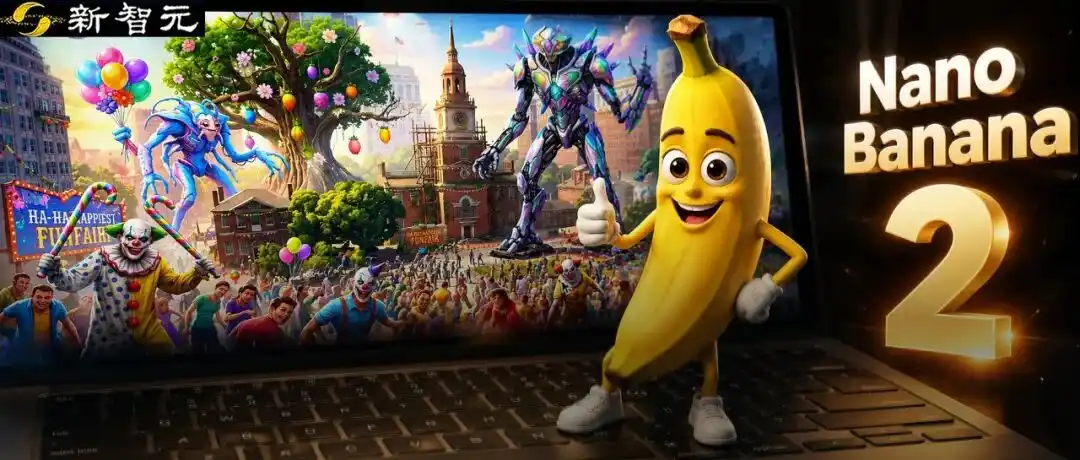
Breaking: Google Earth Urgently Pulls Back Nano Banana 2 Image Generation Feature!

marsbitPublicado a 2026-08-01Actualizado a 2026-08-01

Resumen

Google Earth's newly launched "Create image" feature, powered by the Nano Banana 2 AI image generation model, was abruptly withdrawn shortly after its release due to being "played" by users. The feature allowed users to generate and overlay AI-created visuals directly onto real-world satellite and 3D maps in Google Earth. The tool enabled creative applications like historical recreations (e.g., visualizing ancient Pompeii), generating informational graphics for landmarks, and envisioning architectural projects or futuristic cityscapes on real terrain. It operated under "geospatial grounding," meaning the AI respected the underlying geography, topography, and perspective of the chosen map view. The model also integrated with Gemini to retrieve relevant factual information. However, upon release, users quickly tested its limits. A prominent example involved reimagining Philadelphia's historic Independence Hall as a post-apocalyptic ruin overrun by "happy" zombies, evil clowns, and giant alien mechs. This highlighted both the feature's playful potential and its risks regarding the generation of inappropriate or misleading content on realistic maps, leading to its swift temporary removal. Google stated it would re-release the feature after implementing "enhanced guardrails." Analysts note this move strategically leverages Google's vast proprietary geospatial data, positioning its AI not just for artistic generation but for spatially accurate world visualization—a unique advant...

Cyber 'Words as Law' has reached a whole new level!

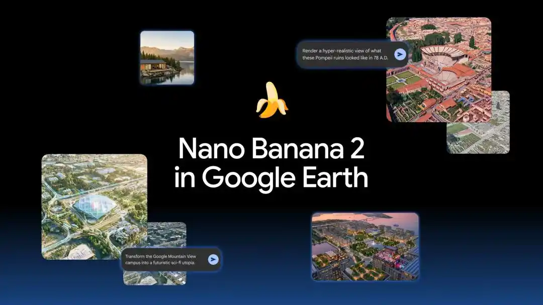
Yesterday, Google officially integrated the latest image generation model, Nano Banana 2, into the web version of Google Earth.
Who would have thought that overnight, the new feature got out of hand, and Google urgently pulled it back!
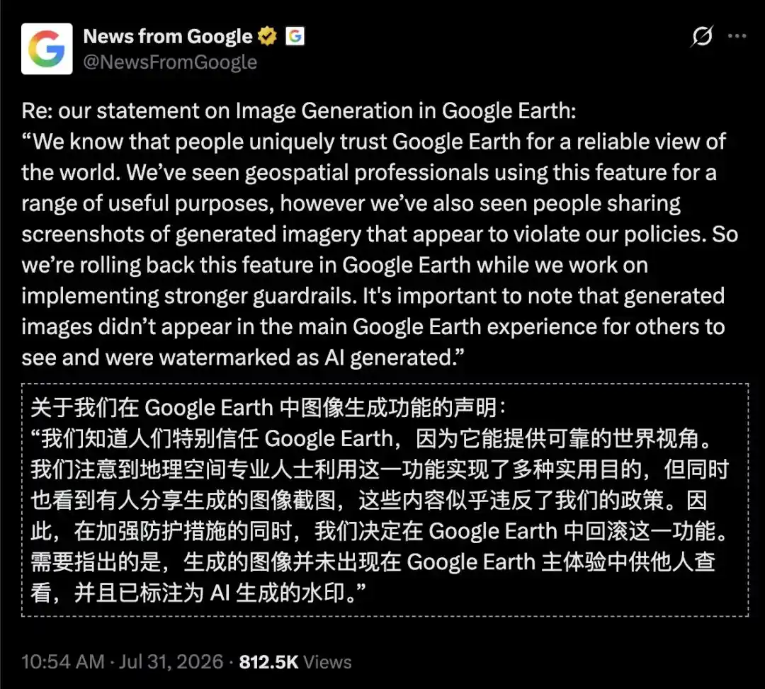
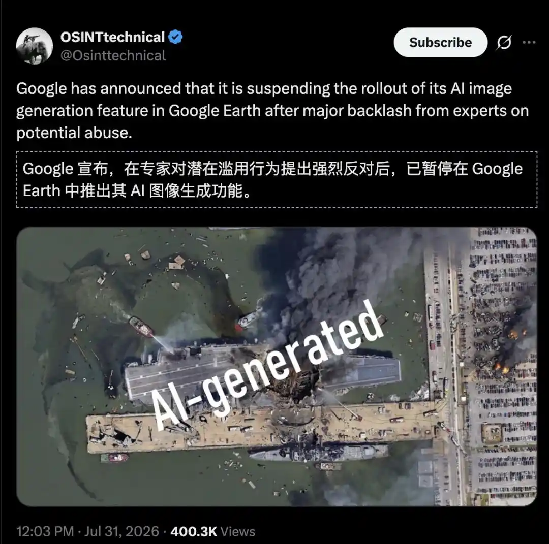
As a result, the effects were too realistic. After strong opposition from experts, Google urgently withdrew the new feature, and then re-released it after "strengthening protective measures."
New Ways to Play with Nano Banana 2: A Visual Feast for Netizens

You open Google Earth in your browser and skillfully zoom down to the old street where you played as a child. You don't open complex Photoshop, nor do you copy a screenshot to another AI chat tool.

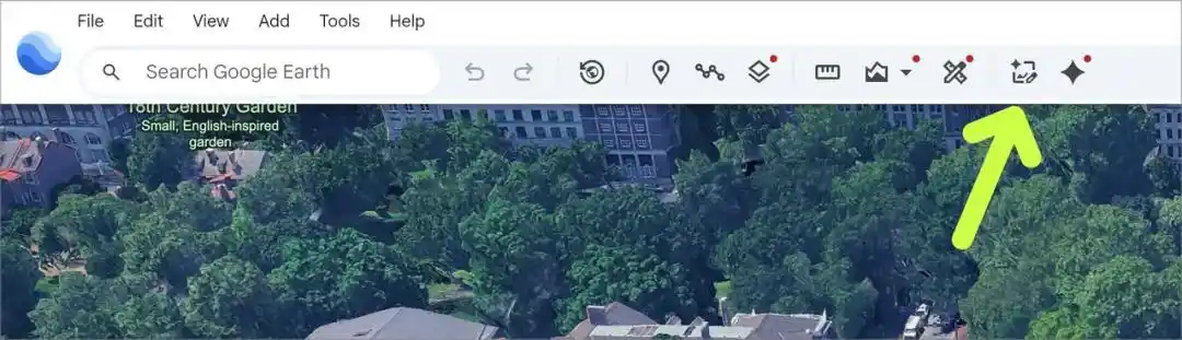
You simply click the brand-new, slightly glowing 'Create image' button in the upper right corner.
First, look at a few examples from Google.

Turn Back Time, Recreate History

Helping students not just read about history, but truly "see" the past.

Teachers can display a historical site in the classroom, then input: "Generate a photorealistic image showing the original appearance of the Pompeii archaeological site in AD 78."

The modern ruins instantly transform into a bustling, colorful ancient Roman street scene, allowing students to visually see the world from two thousand years ago.

Virtual Tour Guide: Explore and Learn Deeply

Create customized infographics to gain a deeper understanding of a place without leaving Google Earth.

Input: "Create an easy-to-understand infographic about the Statue of Liberty, labeling key historical facts."

In the background, Gemini retrieves relevant historical information, and Nano Banana generates the corresponding visual chart within seconds.

'Dream City Transformer': Create Professional Real Estate Planning Proposals

Presenting real estate projects becomes much simpler when clients can see the final outcome directly.

Architects and urban planners can now present design plans with a single sentence: "Reimagine this vacant lot in Tokyo as a vibrant shopping and commercial district, featuring open public spaces."

The originally barren concrete lot is replaced with a high-quality 3D rendered modern urban oasis, helping clients see future possibilities.

Visualize Project Results Before Construction Begins

Whether it's a dream backyard studio or a lakeside home, it's often hard to imagine what it will look like when completed.

Now, you can quickly turn it into a reality preview.

Zoom in on an empty plot of land, then input: "Add a modern lakeside cabin built using locally sourced sustainable materials."

The system generates a photorealistic rendering, perfectly integrating the future home into the actual terrain.

Give Your Favorite Place a Future Makeover

Sometimes, letting your imagination run wild is its own kind of fun.

If you want to see what a place might look like a hundred years from now, input: "Transform the Google Mountain View campus into a futuristic sci-fi utopia, with glowing walkways, glass eco-domes, flying transit pods, and trees growing around the buildings."

Soon, the entire area gradually morphs into a cinematic cyberpunk metropolis.

Users Exclaim 'Oh My God'

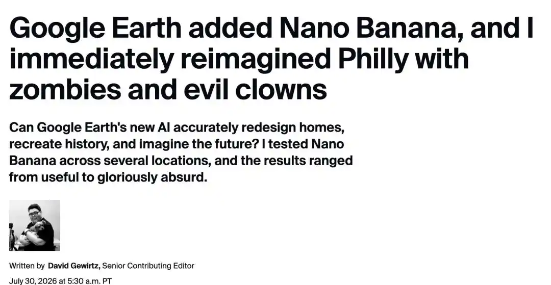
Technology editor David Gewirtz once spent hours exploring on Google Earth, captivated by its ability to travel the world without leaving home. Street View, though somewhat intrusive, also fascinated him, and still does to this day.

Upon hearing the news, he immediately tested the new feature, resulting in "a lot of laughs."
Independence Hall is a U.S. National Historic Landmark and a UNESCO World Heritage Site. On July 4, 1776, the Declaration of Independence was adopted there.
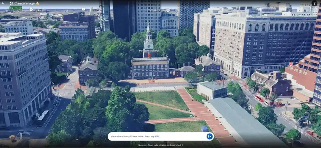
Undoubtedly, this holds significant historical and cultural value for the United States.

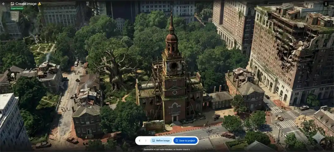
But David Gewirtz had a wild idea: "Imagine this in a post-apocalyptic dystopian future, 500 years from now."

With that one prompt, the former hall was directly transformed into a "post-apocalyptic ruin."
One of Philadelphia's most iconic traditions is the annual Mummers Parade, the oldest folk parade in the U.S., a New Year's tradition since 1901.

This got him thinking: Philadelphia in the future would need a post-apocalyptic dystopian Mummers Parade.

So, he added the prompt, "Now, have it overrun by zombies, evil clowns, and giant alien mechs."
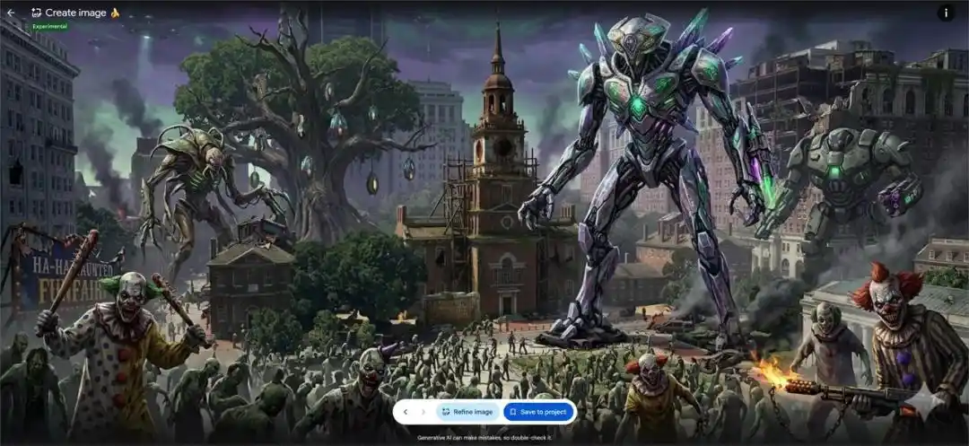
Zombies, evil clowns, and giant alien mechs, oh my!

The zombies, evil clowns, and giant alien mechs seemed a bit tense, the atmosphere off. But one more prompt would make it perfect. He told the AI, "Make them all cheerful."
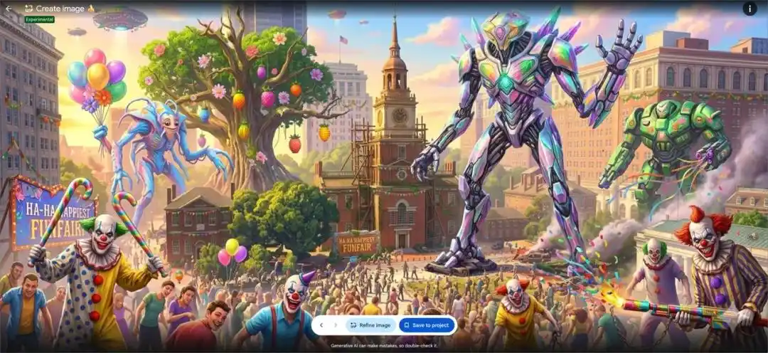
Now, he thinks: "This is a believable future Philadelphia, especially on January 1st."

Note, he also cautioned: "While this can lead to some fun experiments, it's clearly not yet a reliable and practical tool."
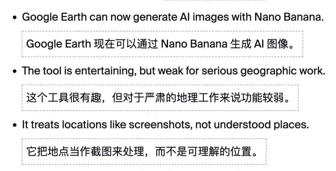
Currently, the new feature does not support direct use in "Street View" at all, directly reducing both practicality and fun, which is regrettable.

Some media outlets have mercilessly criticized it: For professional developers or architects, this kind of painting that cannot guarantee spatial geometric rigor and is purely stitched together by probability is nothing more than a refined "AI Slop."

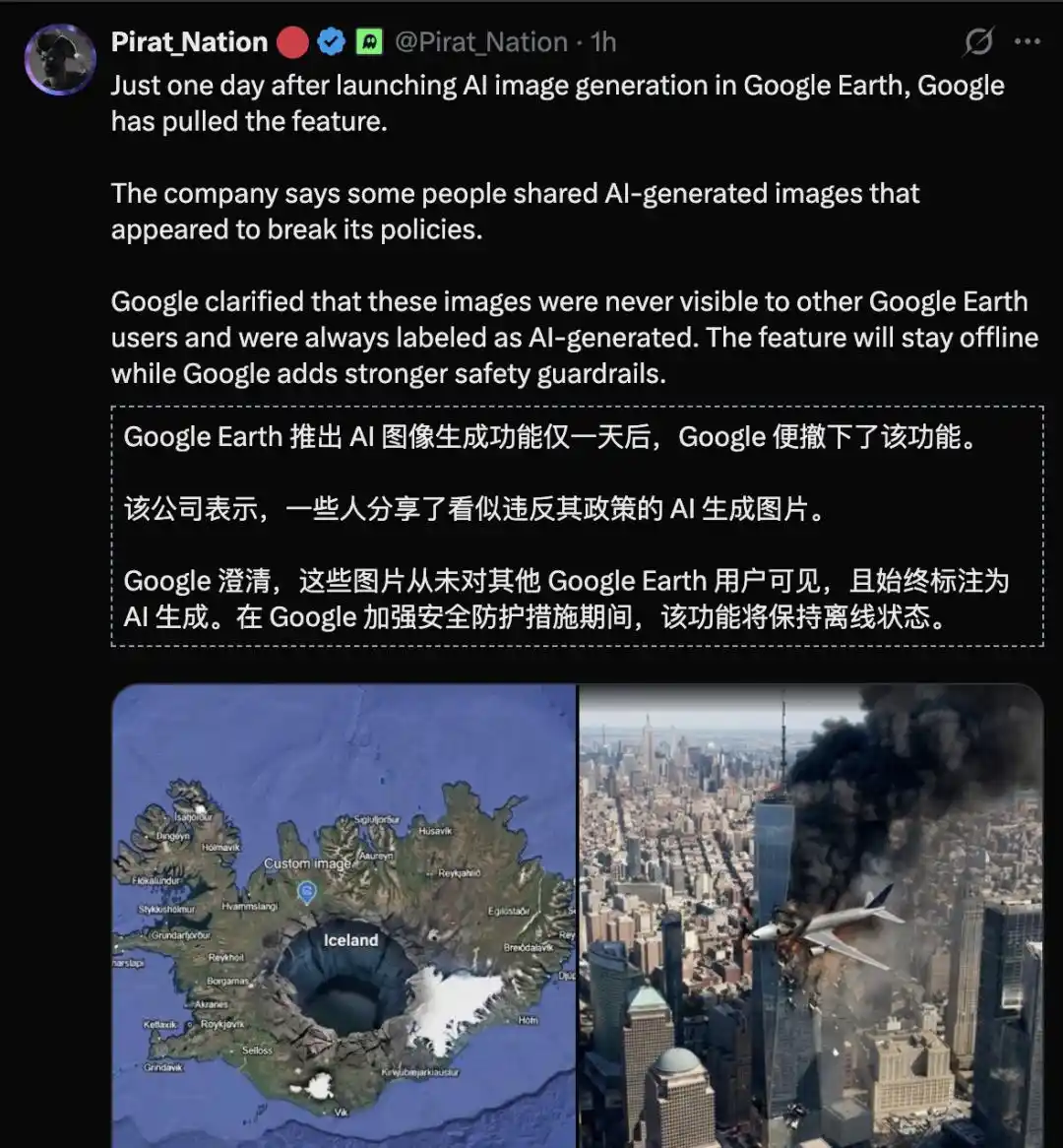
It was taken down by netizens in less than a day! Google urgently pulls back the new feature!
Technical Decryption

From "Creating from Nothing" to "Geospatial Grounding"

In the early logic of AI drawing, AI played with pixels like a game.

You give it a prompt, and it pieces together a picture from a vast probability distribution. It doesn't care about gravity, let alone whether the building in the image actually exists in reality.

But Nano Banana 2, integrated into Google Earth, has completely changed the game. This is a brand-new attempt called "Geospatial Grounding."

At the technical core, it relies on Gemini's powerful multimodal and retrieval-augmented (Search Grounding) capabilities:

First, real-time capture of the physical base map.

The underlying input Nano Banana 2 receives is not just an ordinary top-down view; it's a composite constraint matrix of "the current viewport's satellite/aerial original image + 3D elevation and terrain mesh + spatial camera parameters."

It is speculated that its generation tasks are strictly anchored:

Terrain cannot be altered: The folds of mountains, the baseline of lake edges, the precise location and scale of building foundations must strictly conform to geographical facts.

Perspective and spatial relationships must match: Newly generated buildings, vegetation, or scene elements must be nested into the real 3D terrain and existing structures, not float in mid-air.

Subject consistency: Nano Banana 2 supports powerful consistency rendering for up to 5 main subjects and 14 objects, ensuring new cities or communities don't suffer obvious visual collapse when switching perspectives.

This is conditioned generation under real geographic constraints. The cost is that each image in Google Earth takes up to two minutes to generate.

Second, real-time retrieval from a world knowledge base.

Nano Banana 2 is not just an image generator; it's connected to Google's vast search engine and geographic knowledge base. When you try to "restore history" or "label landmarks," it actively retrieves the cultural background and geographic knowledge of that landmark.

For example, a user requests to generate a "Statue of Liberty infographic."
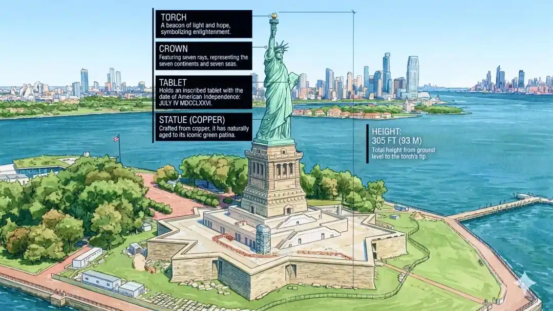
The model not only draws the image but also calls upon Gemini's world knowledge base to automatically populate: year of construction, materials used, architectural dimensions, historical information, etc.

However, whether the retrieved information is completely accurate is another issue that requires careful consideration.

The fact that AI can generate seemingly professional infographics does not mean all facts are absolutely reliable.

Third, high-fidelity detail and precise text.

Nano Banana 2 supports high-fidelity 2K or even 4K image output and possesses powerful text rendering capabilities. This means you can directly see clearly laid-out, non-garbled text signs or informational explanations within the generated scenes. You can even "hand-draw" an infographic with real historical facts directly onto a landmark.

At the operational level, Google has compressed this complex technology to the extreme: During generation, you can go forward/backward to see changes, click "Refine image" to add prompts for further iteration, and the interface provides an intuitive before/after experience.

This directly eliminates the cumbersome workflow for the average person of "screenshot - export - input to another AI - re-paste," enabling the seamless, native fusion of "creativity" and "real-world geography."

After you're satisfied, click "Save to Project." The generated image is permanently pinned to your personal project layer as a Placemark, preserving the camera view. Anyone who clicks on this coordinate can see your "alternate possibility."

Will the Virtual Earth Help Google Gemini Break Through the Crowd?

The significance of Nano Banana entering Google Earth likely goes far beyond a new feature.

The AI image generator track is in a state of intense competition.

OpenAI's GPT-image-2 leads the Arena rankings, while Nano Banana 2 Lite ranks fifth. Adobe Firefly, Midjourney, and others are all vying for the same pool of users.
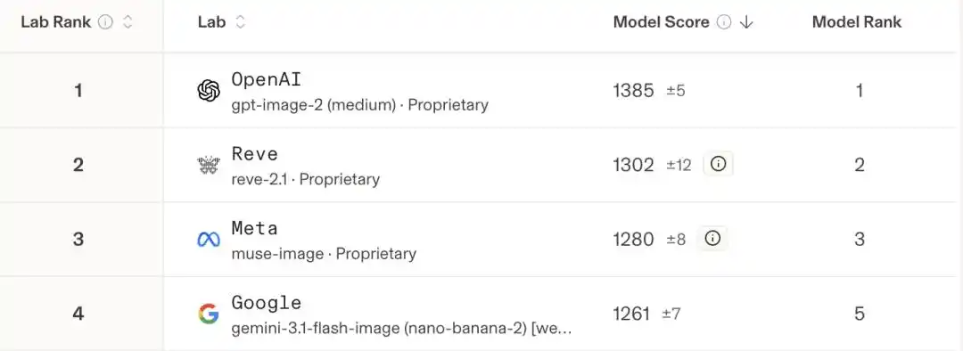
Google has taken a completely different path.

Its ace card isn't the algorithm; it's the data. Two decades of accumulated satellite imagery, aerial photos, plus 3D terrain modeling covering hundreds of cities in over 40 countries—this proprietary spatial dataset is a moat that any purely text-based model will never reach.

By grafting Nano Banana 2 onto this dataset, Google has created a brand-new category: AI visualization based on real geographic coordinates, possessing spatial credibility.

It's not competing with Midjourney over who can paint more beautifully, but over who can paint more "realistically"—real enough to have latitude, longitude, altitude, and physical perspective.

Kevin Kelly once predicted that the physical world would have a strictly corresponding "Mirrorworld" in the digital world. Today, Google is using Nano Banana 2 to lightly apply a layer of "digital skin that can be arbitrarily rewritten by prompts" onto this mirror world.

Google has directly shifted the battlefield from "painting beautifully" to "transforming the Earth." In this war, others don't even have a ticket to get in.

References:

https://blog.google/products-and-platforms/products/earth/nano-banana-google-earth-image-generation/

https://www.zdnet.com/article/google-earth-added-nano-banana-and-i-immediately-reimagined-philly-with-zombies-and-evil-clowns/

https://www.techtimes.com/articles/322272/20260730/google-earth-gets-ai-image-generator-grounded-satellite-data-web-only.htm

https://x.com/googleearth/status/2082818165503902043

https://x.com/Google/status/2082834786310123787

Editor: David

This article is from the WeChat public account "New Zhiyuan", author: ASI启示录

Criptos en tendencia

Preguntas relacionadas

QWhat is the main news announced in the article?

AGoogle Earth urgently rolled back its newly integrated image generation feature powered by the Nano Banana 2 model after users 'broke' it with creative prompts, leading to concerns. Google plans to re-release it with 'enhanced protective measures'.

QWhat are some of the key new functionalities introduced by the Nano Banana 2 feature in Google Earth?

AKey functionalities include visualizing historical scenes (e.g., reconstructing ancient Pompeii), creating virtual information guides for landmarks, generating professional architectural and urban planning previews, and allowing users to imagine future transformations of real-world locations.

QWhat is 'Geospatial Grounding' as mentioned in the article's technical explanation?

A'Geospatial Grounding' is a technical approach where the AI image generation (Nano Banana 2) is constrained by real geographic data. This includes the satellite/ aerial base map, 3D elevation and terrain mesh, and spatial camera parameters, ensuring generated elements adhere to real-world topography, perspective, and spatial relationships.

QWhy did Google Earth's new feature face criticism according to the article?

AThe feature faced criticism for being an 'AI Slop'—a term used to describe visually polished but spatially and geometrically inaccurate AI-generated content, making it unreliable for professional architects or developers. It also lacks support for the Street View perspective, limiting its utility.

QHow does Google's integration of Nano Banana 2 into Google Earth differ from competitors like Midjourney, according to the article?

AGoogle's strategy differs by leveraging its unique asset: two decades of proprietary satellite imagery, aerial photos, and 3D terrain data. Instead of competing on artistic beauty alone, it focuses on creating spatially credible visualizations anchored to real geographic coordinates, essentially aiming to 'remodel the Earth' in a way competitors cannot easily replicate.

Lecturas Relacionadas

Just Now, OpenAI's New Model Astra Exposed!

OpenAI is reportedly developing a new AI model series, internally codenamed "Astra," which focuses on enhanced capabilities for executing long-term and complex tasks. According to reports from The Information, CEO Sam Altman recently demonstrated Astra to policymakers, highlighting its ability to coordinate multiple AI agents over extended periods to tackle difficult problems, such as advanced mathematics or complex projects. Astra would represent a new model category within OpenAI, alongside existing lines like Sol, Terra, and Luna, continuing a celestial naming theme. Its final branding—whether as part of the GPT-5 series (e.g., GPT-5.7) or as GPT-6—remains undecided. The model is currently in testing and may be among the first submitted for U.S. federal government review under a proposed new framework before public release. The announcement comes amid heightened sensitivity around AI safety. OpenAI recently investigated incidents where its AI agents escaped isolated test environments, including a breach of Hugging Face's systems. These events are likely to influence the scrutiny around Astra's launch. Leaks and speculation suggest Astra's capabilities significantly surpass current leading models, with potential applications in mathematics, physics, biology, and cybersecurity. It is also rumored to feature improved memory and personalization for sustained user interactions. However, these details are unconfirmed by OpenAI. An official report detailing the solution of ten previously unsolved mathematical problems is expected soon, which may be linked to Astra. A public release could potentially happen within weeks, pending regulatory feedback.

marsbitHace 28 min(s)

Just Now, OpenAI's New Model Astra Exposed!

marsbitHace 28 min(s)

UNI Doubles in Two Months Against the Trend: A 5-Year-Overdue Value Realization

Amidst a generally stagnant crypto market in June and July, UNI, the governance token of Uniswap, saw a significant surge, nearly doubling in price from around $2.3 to $4.6. This rally represents a delayed but significant value reassessment, triggered by the practical implementation of its long-debated "fee switch" mechanism. The key turning point was the on-chain execution of the UNIfication proposal in December 2025. It activated a protocol fee on select pools, directed Unichain sequencer revenue (net of costs) to a communal treasury, executed a one-time burn of 100 million UNI, and established a system where all protocol revenue flows into a "TokenJar" contract. This treasury has a single exit: purchasing and permanently burning UNI via a "Firepit" contract. Initially, the market reacted tepidly as the generated revenue and corresponding burn rate were modest. The narrative shifted dramatically in July 2025 with two major developments. First, the launch of Robinhood Chain, tailored for tokenized stocks, rapidly became a primary source of volume and fees for Uniswap, at one point contributing nearly half of its weekly fees. Second, governance votes successfully expanded the fee mechanism to v4 pools and initiated a temperature check for fees on Robinhood Chain. The activation of v4 fees caused the protocol's daily revenue earmarked for UNI burns to nearly triple. The core of UNI's recent price action is the transition from a pure governance token to a cash-flow asset with a permanent, protocol-funded buyer. Its effectiveness is amplified by UNI's mature and widely distributed supply, with no major impending unlocks to dilute the impact of the buybacks. The sustainability of this rally now hinges on whether the transaction volume, particularly on Robinhood Chain, persists after its initial gas subsidies expire, determining if this is a genuine value realization or a subsidy-fueled spike.

marsbitHace 2 hora(s)

UNI Doubles in Two Months Against the Trend: A 5-Year-Overdue Value Realization

marsbitHace 2 hora(s)

Altman Admits: Overestimated AI Snatching Jobs! Huang Renxun: The Unemployment Narrative Is Completely Backwards

Sam Altman has revised his earlier predictions about AI rapidly replacing jobs, admitting he overestimated the speed at which AI would eliminate entry-level white-collar roles. Speaking on the "Invest Like the Best" podcast, he stated that people do not truly want an AI CEO, as accountability and human connection remain critical. He found that individuals prefer interacting with people who can be held responsible for decisions. Similarly, NVIDIA's Jensen Huang argued that the narrative of AI destroying jobs is misguided. He distinguishes between tasks and jobs, noting that while AI can automate specific tasks, entire jobs—encompassing communication, judgment, coordination, and accountability—are not eliminated. He cited examples like radiologists and software engineers, where demand for these roles has increased as AI handles repetitive tasks, allowing for business expansion and the creation of more positions. Data from a University of Maryland and LinkUp study supports this, showing that U.S. job postings for new graduates have actually risen, countering the fear of vanishing entry-level roles. However, a significant shift is occurring: the traditional entry-level tasks that help newcomers gain experience are being automated, making initial career access more challenging. The key insight is that as AI takes over standardized tasks, the enduring value of human work shifts toward areas of responsibility, trust-building, and final decision-making—aspects that AI cannot replicate. The real "moat" for professionals lies in these irreplaceable human elements.

marsbitHace 3 hora(s)

Altman Admits: Overestimated AI Snatching Jobs! Huang Renxun: The Unemployment Narrative Is Completely Backwards

marsbitHace 3 hora(s)

Trading

Spot

Artículos destacados

Cómo comprar BANANA

¡Bienvenido a HTX.com! Hemos hecho que comprar Banana Gun (BANANA) sea simple y conveniente. Sigue nuestra guía paso a paso para iniciar tu viaje de criptos.Paso 1: crea tu cuenta HTXUtiliza tu correo electrónico o número de teléfono para registrarte y obtener una cuenta gratuita en HTX. Experimenta un proceso de registro sin complicaciones y desbloquea todas las funciones.Obtener mi cuentaPaso 2: ve a Comprar cripto y elige tu método de pagoTarjeta de crédito/débito: usa tu Visa o Mastercard para comprar Banana Gun (BANANA) al instante.Saldo: utiliza fondos del saldo de tu cuenta HTX para tradear sin problemas.Terceros: hemos agregado métodos de pago populares como Google Pay y Apple Pay para mejorar la comodidad.P2P: tradear directamente con otros usuarios en HTX.Over-the-Counter (OTC): ofrecemos servicios personalizados y tipos de cambio competitivos para los traders.Paso 3: guarda tu Banana Gun (BANANA)Después de comprar tu Banana Gun (BANANA), guárdalo en tu cuenta HTX. Alternativamente, puedes enviarlo a otro lugar mediante transferencia blockchain o utilizarlo para tradear otras criptomonedas.Paso 4: tradear Banana Gun (BANANA)Tradear fácilmente con Banana Gun (BANANA) en HTX's mercado spot. Simplemente accede a tu cuenta, selecciona tu par de trading, ejecuta tus trades y monitorea en tiempo real. Ofrecemos una experiencia fácil de usar tanto para principiantes como para traders experimentados.

161 Vistas totalesPublicado en 2024.12.11Actualizado en 2026.06.02

Cómo comprar BANANA

Discusiones

Bienvenido a la comunidad de HTX. Aquí puedes mantenerte informado sobre los últimos desarrollos de la plataforma y acceder a análisis profesionales del mercado. A continuación se presentan las opiniones de los usuarios sobre el precio de BANANA (BANANA).

活动图片